Welcome to WxChaser.com!
June 24, 2006 - Severe Warned storms from Glencoe to New Market, MN
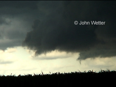
As the year has gone, this day has probably been the most fun and interesting so far. We first met up with the storms as they were coming in to Glencoe. The lead cell put on quite a good show for a while producing a menacing looking wall cloud for a short time which I reported through the local skywarn net.
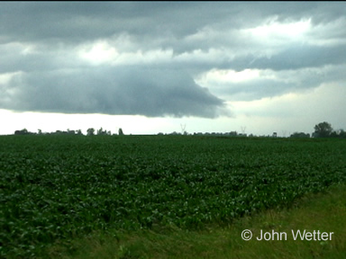
As the storm moved on, it quickly became outflow with a great shelf cloud leading the way near Cologne.
We stayed a little too long here and started to get hit by hail that got up to about dime size which I reported through the Metro Skywarn net. The hail was still getting larger as we quickly got out of there. LSR's show it got sizably larger after we left.
We headed down to Jordan around the storm and got hit by some smallish hail again here.
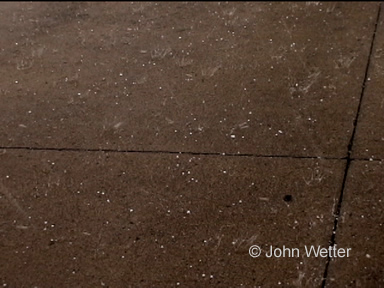
As we moved to the South and East, we headed down toward New Market where we again got hit by hail up to dime sized. The only reason I even stayed around there was I hadn't heard any reports of larger hail.
We continued East toward Hampton where we ran in to Rory Groves who was also chasing. It's always fun to see people out in the field!