Welcome to WxChaser.com!
These images were put together using level 2 data from KMPX for the morning of July 23rd, when a large bow went through the I-94 corridor causing extensive damage in Stevens, Swift and Pope counties, and continued to cause damage all the way down to the Chicago area. I was at the Skywarn desk at MPX through most of the event. Below are a few screen captures and animations.

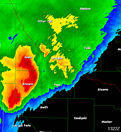
The base reflectivity image from 1322Z.
Here is a smoothed version using GRLevel2 smoothing.
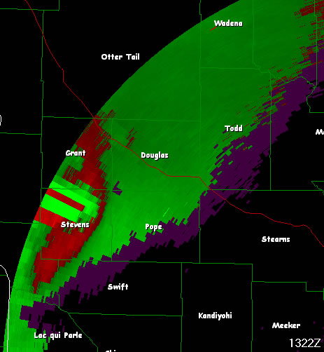
As you can see, there were severe dealiasing issues. I did my best to dealias the velocity using different speed coorelations and Nyquist multipliers. The original data had a lot of dealiasing artifacts in the middle of the bow.
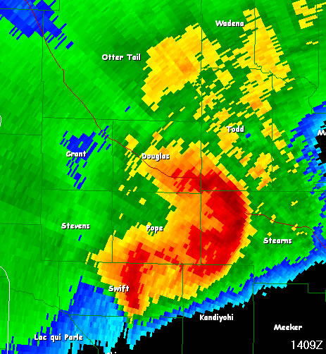
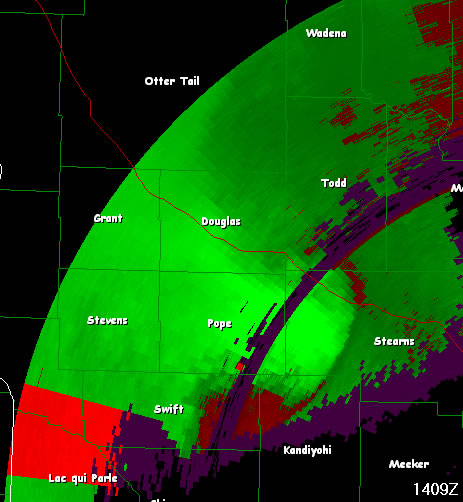
At 1409Z, the cell had moved in to Stearns county. While still showing strong velocities on radar, the number and intensity of damage reports decreased.
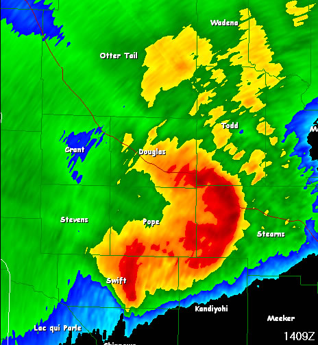
Here's another smoothed version.
I got this Velocity image to clean up pretty nicely after adjusting some of the dealiasing values.
Now, I also put together a couple animations, one of the base reflectivity, and the other is base velocity.