Welcome to WxChaser.com! |
|
|
|
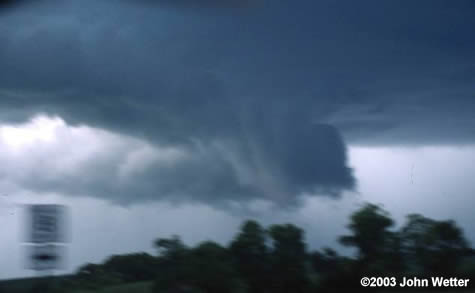
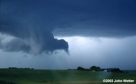
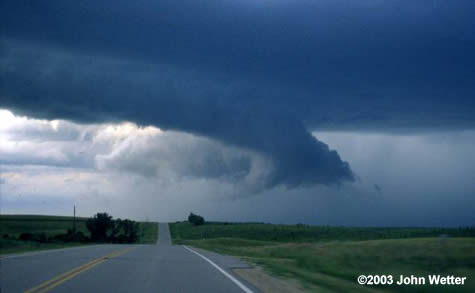
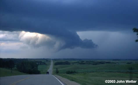
July 6, 2003 Supercell and Wall Cloud Jamie and I initially targeted Montevideo as it seemed the best compromise for shear/cap/energy. The setup was some ongoing convection in Northern Minnesota. A cold front was sweeping to the SE on a line from North Central MN, to thw Southwest into Northern Nebraska. The front was expected to fire up to the north, and then work its way south as the day progressed and the cap weakened. In MVE we saw towers start to go up around 6-6:30. We immediately moved to them and watched the bottoms evaporate right out from under them! A few minutes later we could see a beautiful anvil form to the north as we watched our towers fizzle. We moved north to Benson, and then to MOX, where we saw the wall cloud that got tornado warned on. We followed along with this storm to watch the wall cloud make all kinds of action (sorry, a bit out of focus) to the northeast of Morris. It looked like it was just about to do it at one point, about 5 miles SW of Brandon. It was quite a site! You could see a beautiful RFD (RFD shot 2) push into the back. It appeared to be undercut from here on out. We followed with the storm up to AXN, and then points east. We left the cell at Sauk Centre and drove back home. A great day to be out there. Glad we had good visibility to adjust to the new cells and had a few radar shots as the storm initially approached MOX. It was really a gorgeous wall cloud on in. I don't think it was going to put down a tube though until we were up toward Brandon. Some RFD started cutting in and it rapidly approached the ground, but it undercut the rotation and from there on out it was just a nice site. Called it in to MPX, but before I was off the phone with them, I told them it was being undercut, so they didn't reissue TOR, and went with a SVR. The storm moved East into Todd county and practically evaporated as it moved into much more stable air. For the most part, the cap won. We at least got one gorgeous storm out of it. The rest of the front never did fire. |