|
Jamie, Theresa Caspers, and I left STC around 1:30pm, myself having
woke up at 12:30, headed for SW Minnesota. A tornado warned cell
was approaching Brookings, SD at that time. We went without a laptop,
as it was down at Jamie's parents' place. I was a little uneasy
with that, as I have obviously become dependant on at least near-real-time
data.
From STC, we took 23 south to 71 south at Willmar. We stayed on
71 south through Redwood Falls towards State Highway 68. Just south
of Redwood Falls, We got into rain, and then into heavy rain! At
the time there was a SVR for Redwood County, naming the storm location
being 12 SW Redwoods Falls with TOR warnings on cells in Lincoln
and Lyon counties. So, we blasted south. At highway 68 we headed
east to get out of the rain. As we tried to get east on 68, the
rain came in buckets, along with some hail. There were only a few
stones, but they appeared to be descent sized. Only heard one hit
the roof. We then went south on 13, and east on Redwood Co. 4, and
back to 68, as it ran to the southeast. At the intersection of 68
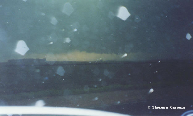
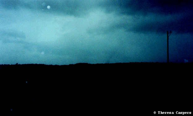
and state 4, we came out to the clearing to notice a beautiful updraft
base over Sleepy Eye, to the Southeast. It had very nice definition
with a prominent
lowering. Watching for a minute or two, a very large funnel
cloud started to lower toward the ground. It had a beautiful
shape to it, much like the stovepipe appearance we all know and
love. However, as it got to the ground it started to dissipate.
I would say that it was about 3/4 of the way to the ground. I called
Meredith to call it in, as I couldn't get a hold of Chanhassen.
As it dissipated, we again became engulfed in rain.
From there we went north on 4 to Nicollet Co. road 5 and blasted
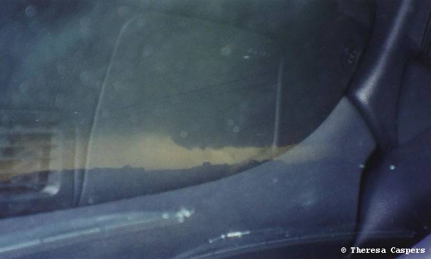
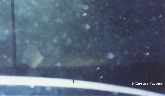
east. Just west of Klossner, we couldn't believe what we saw! Just
south of the road a few miles, there was a beautiful rope tornado!
(contrast
adjusted) It started from the ground up, extending toward the
cloud base before dissipating. We stopped and watched it do this
two more times. Absolutely gorgeous! I called Meredith to phone
it in, as I was not being able to keep a cell phone connection,
even with an external antenna. It got phoned in and a TOR
was issued shortly after for Nicollet county until 6:15pm. The warning
said it was spotted 3 east, while we were actually 3 west of Klossner.
It probably got jumbled by the bad cell phone connection, but none
the less, it got out and the warning was issued. As we went through
Klossner you could see people out on their porches looking for the
tornado. After we passed Klossner, we started to see quite a few
patrol cars, as well as spotters along the road. That was good to
see.
Past Klossner, we took 111 north after talking to Jerry Veverka.
He said that the cell down toward Mankato was bowing out and that
there were TOR warnings on cells in Rice and Goodhue counties. While
sitting at the intersection of 5 and 111, a chaser passed us and
went straight east on 5. The car appeared to be Josh Jans'. Josh,
let me know if that was you!
With the cells obviously blasting east, we headed up 111/22 on
our way home. In New Auborn we saw considerable street flooding.
We got on 15, and came right back to STC and went out to Outback
to have our steak dinna!
Overall, just an awesome day! Got up after noon, went chasing,
got a tornado, had our steak dinna and were home by 9:15! Can't
do much better than that! After many disappointing chases this year,
just a wonderful day.
I'd like to thank Meredith Lindrud and Jerry Veverka for their
radar help (radar loop AVI, 18 MB, AVI-Divx
encoded, 3.43MB) a couple times, as we were data-less today.
NOAA weather radio coverage was very good down there, we didn't
miss a warning. That was very nice to see. It was also nice to see
the numerous spotters out in the field.
Route: State 23 to US 71, to state 68, to county 13, to county
4, to state 68, to state 4 to county 5 to state 111/22, to 15 and
home.
|